 LYCIAN STONES
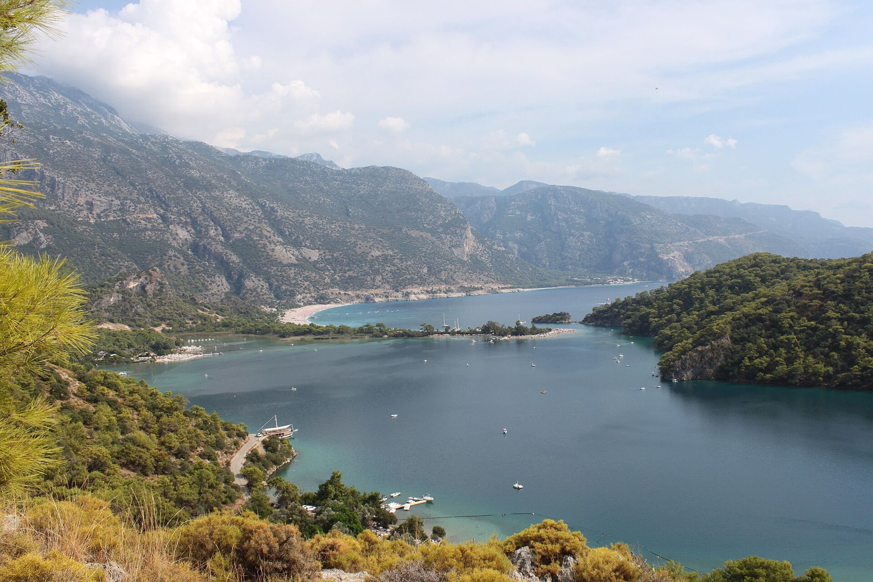
The Lycian Way begins in the hills behind Ölüdeniz, near the village of Ovacık, and its first days are among the most dramatic on the whole route. The trail climbs onto the slopes of Babadağ, the mountain that rises straight from the sea here, and then follows the coast southwards at height, through pine woods and stony hamlets, to Faralya and Kabak. For most of the way the sea lies hundreds of metres below you, and the land between you and it is cliff.
This is a walk rather than an archaeological visit. You pass no great city, and the stones you notice are the work of farmers and herders: terrace walls, threshing floors, cisterns, field huts. Yet the path itself is old in the way that matters on this coast. Much of the Lycian Way follows mule tracks and village paths that linked settlements long before anyone painted waymarks on them, and walking them shows you how the people of these mountains moved between coast and upland.
Where the trail begins
The western start of the trail is marked near Ovacık, above the resort strip of Ölüdeniz and Hisarönü. From there the route is waymarked with red and white painted stripes on rocks and walls, the same marks used along the whole trail of about 500 km and more towards Antalya. The marks are generally clear, but they fade and are sometimes lost where tracks have been widened into roads, so carry a printed or offline map of the route and check it at each junction.
The first section is a long, steady climb on rocky ground. You gain height quickly, and the view opens over the lagoon of Ölüdeniz and back towards the bay of Fethiye. The path then contours along the mountainside, passing small settlements where a few houses, gardens and goat pens cling to the slope. Expect a full day of walking to Faralya for most people, with stretches that are rough underfoot and very little shade once the sun is high.
Faralya and the rim of the gorge
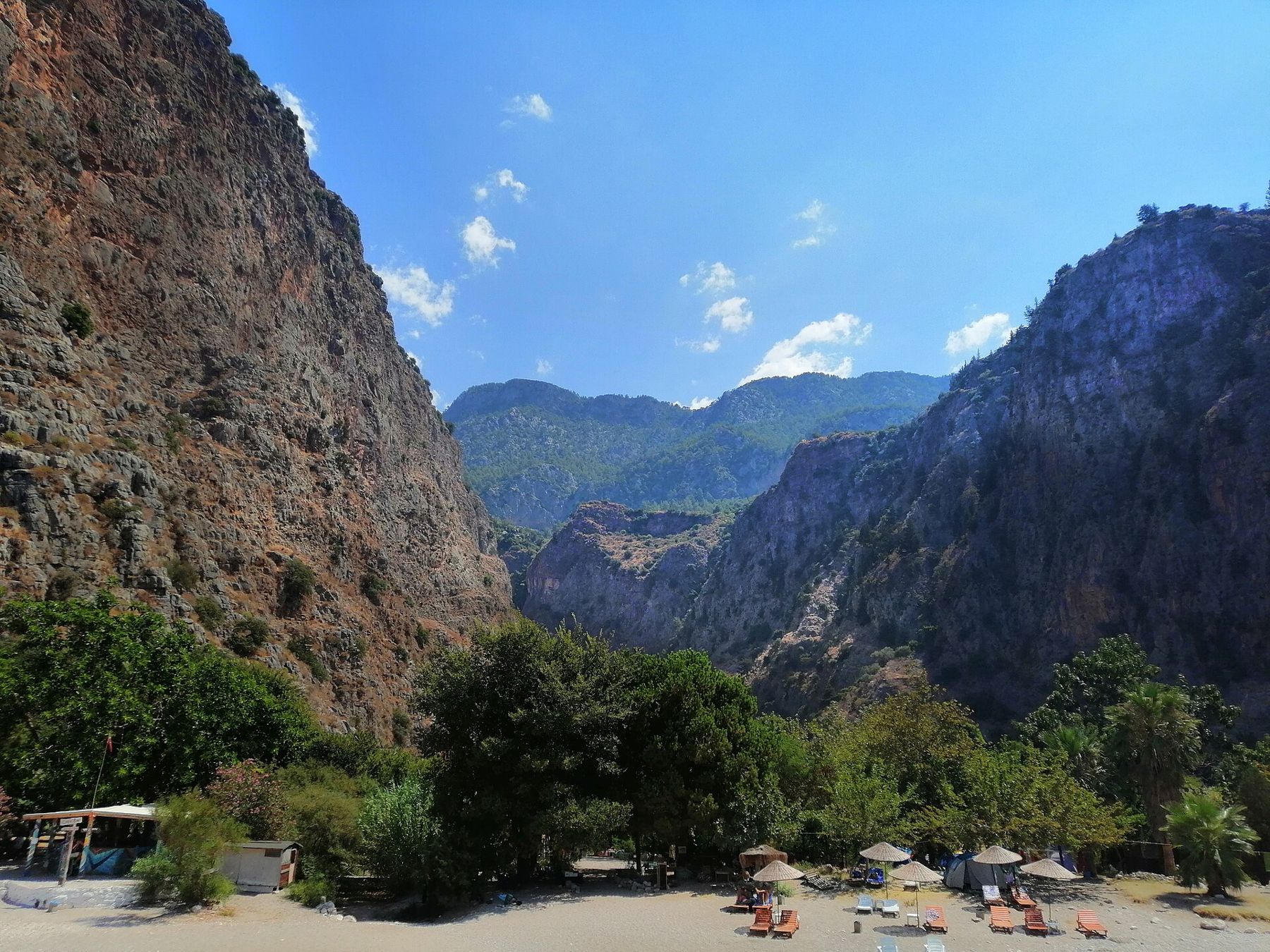
Faralya, officially named Uzunyurt, is a village spread along the top of the cliffs. Below it lies Kelebekler Vadisi, the Butterfly Valley: a narrow gorge whose walls drop almost sheer to a small beach and the sea. The valley takes its name from the butterflies and moths that gather in its shaded floor in summer, including a striking tiger moth, and it is a protected natural area.
From the rim the view is the reason most people come this way. You look straight down into the gorge, see the strip of shingle at its mouth and the boats that bring day visitors round the coast. Stay well back from the edge. The ground at the top is loose and broken, there are few barriers, and a slip here is not survivable.
There is a path from Faralya down into the valley. It is steep and dangerous: a scramble down rock faces with fixed ropes in places, where walkers have been badly injured and killed. Do not treat it as part of the trail or as an easy detour. If you want to see the valley floor, the usual way in is by boat from Ölüdeniz. If you are still thinking about the path, ask locally about its current state and closures first, and turn back if you have any doubt about your footing, your shoes or the heat.
On to Kabak
South of Faralya the trail continues along the high ground to Kabak, a scattered settlement above a valley that opens to its own small bay. The walk between the two villages is shorter than the first day, a couple of hours for most walkers, on paths and stretches of quiet road. The coast here grows wilder: pine forest runs down to the cliffs, and the mountains behind rise towards the high pastures that shepherds have used for centuries.
Kabak's lower valley is reached by a steep track and paths that drop sharply towards the sea. Like the descent at Faralya, these are hard on the knees and harder on the way back up, especially in the afternoon. Beyond Kabak the Lycian Way climbs inland again towards Alınca, a high, exposed village, and that next stage is one of the most demanding of the whole route. Treat Kabak as a sensible place to stop and decide, rather than a point to push on from late in the day.
Water, heat and timing
Water is the first practical question on this stretch. Villages have fountains and taps, and there are cisterns along the path, but none of these can be counted on: a fountain may be dry in late summer, and cistern water should not be drunk without treatment. Carry enough for the whole day, at least two or three litres per person, more in warm months.
Heat is the second. Summer midday on these open slopes is dangerous, with reflected heat from bare limestone and almost no shade on the climbs. Spring and autumn are the walking seasons here. Start at first light, rest in the middle of the day, and finish before the late afternoon. In winter the paths are walkable on many days but can be wet and slippery, and short days leave little margin.
- Check the weather, and any trail closures or fire warnings, before you set out.
- Tell someone your route and expected time of arrival.
- Wear boots or sturdy shoes with good grip; the paths are loose stone.
- Minibuses link Fethiye, Ovacık and Faralya; times change with the season, so check before you go.
Stones along the path
The built landscape on this section is modest and easily missed. Look at the terrace walls on the slopes above the villages: dry stone, laid without mortar, holding back narrow strips of soil for grain, vines or fruit trees. Many are now abandoned and slumping. Round threshing floors, paved with flat stones and edged with a low kerb, show where grain was beaten out in summer. Small domed cisterns stand beside the path to catch winter rain. Their dates are rarely recorded, and most belong to the last few centuries rather than to antiquity, but they follow a practice as old as settlement on this dry coast.
The ancient cities of western Lycia lie inland and to the south of this stretch. If the walk leaves you curious about the people who first lived on these mountains, the rock-cut tombs of Tlos and Pinara are a short drive from Fethiye, and reading a Lycian tomb makes sense of the house-shaped facades you will see cut into cliffs across the region.
Fitting it into a longer walk
Many walkers use Ovacık to Faralya and Kabak as a first test before committing to more days. It shows you quickly what the Lycian Way asks of you: long climbs, uneven ground, heat and the need to plan water. If it goes well, the route continues south and east along the coast for many days, past ancient sites and through mountain villages. The overview of walking the Lycian Way sets out the sections, seasons and how to break the trail into manageable stages.
Whatever you plan, keep the cliffs in mind. The beauty of this stretch is the height and the drop, and the same drop is the main danger. Walk the rim, look down, and leave the descents to those who have checked the current conditions locally and are equipped for them.