 LYCIAN STONES
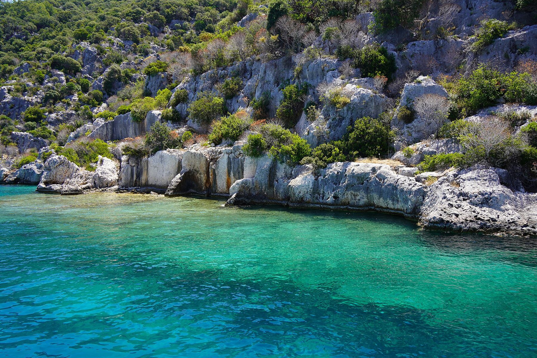
Kekova is the name of a long, bare island and, more loosely, of the sheltered waters between it and the mainland east of Kaş. Here the sea has crept over the edges of ancient settlements. On the island's northern shore, foundations, walls and rock-cut steps run straight into the water; on the mainland opposite, the village of Kaleköy climbs a hill to a castle built on the site of ancient Simena, and a Lycian sarcophagus stands in the shallows below.
It is a place seen mostly from a boat, slowly, with the engine low. The ruins are not grand. Their interest lies in the line where stone meets water, and in what that line says about earthquakes, sea level and the long life of a coast.
What the sunken ruins are
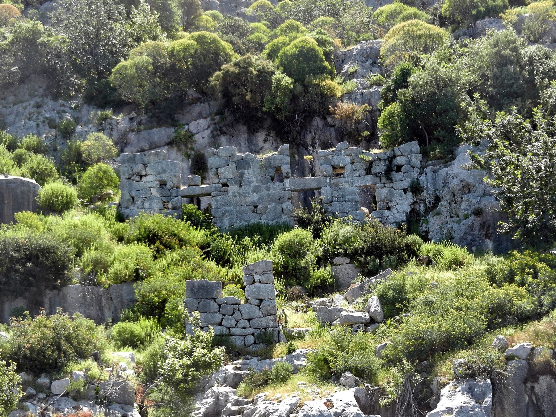
The submerged remains along the Kekova shore belonged to small Lycian and later Roman and Byzantine settlements, harbour towns and fishing places that lived from the sea. Their walls and houses were built on the shore and up the slopes; today the lowest of them lie under a metre or two of water. You see house walls cut into the rock, flights of steps that descend into the sea and end, the outline of a harbour wall and, in places, the bases of buildings rising from the seabed.
How they came to be under water is usually explained by earthquakes, often dated to the second century AD, together with the slow sinking of the land along this coast over many centuries. The general picture is well established; the exact sequence and dates for each stretch of ruins are less certain, and you should treat any precise date you hear with some caution. What you can see plainly is that people kept living here long after: later building sits on top of older walls, and Byzantine traces are common.
Why you cannot swim over the ruins
The Kekova area is a protected area, and swimming, snorkelling and diving over the sunken ruins are prohibited. Boats keep their distance, anchoring away from the archaeological zone, and passengers are not allowed into the water there. The reasons are simple: the stones are fragile, loose blocks and pottery fragments are easy to disturb or remove, and the site's value lies precisely in being left in place.
The rule is enforced, and it is worth respecting even where you see someone else ignoring it. The water is clear enough that you lose almost nothing by looking from the deck. On a calm day, with the sun behind you, the walls under the surface are sharp and close. Boats usually stop for swimming at permitted bays elsewhere in the area; follow the crew's instructions on where that is allowed.
The water is clear enough that you lose almost nothing by looking from the deck.
Simena and the castle at Kaleköy
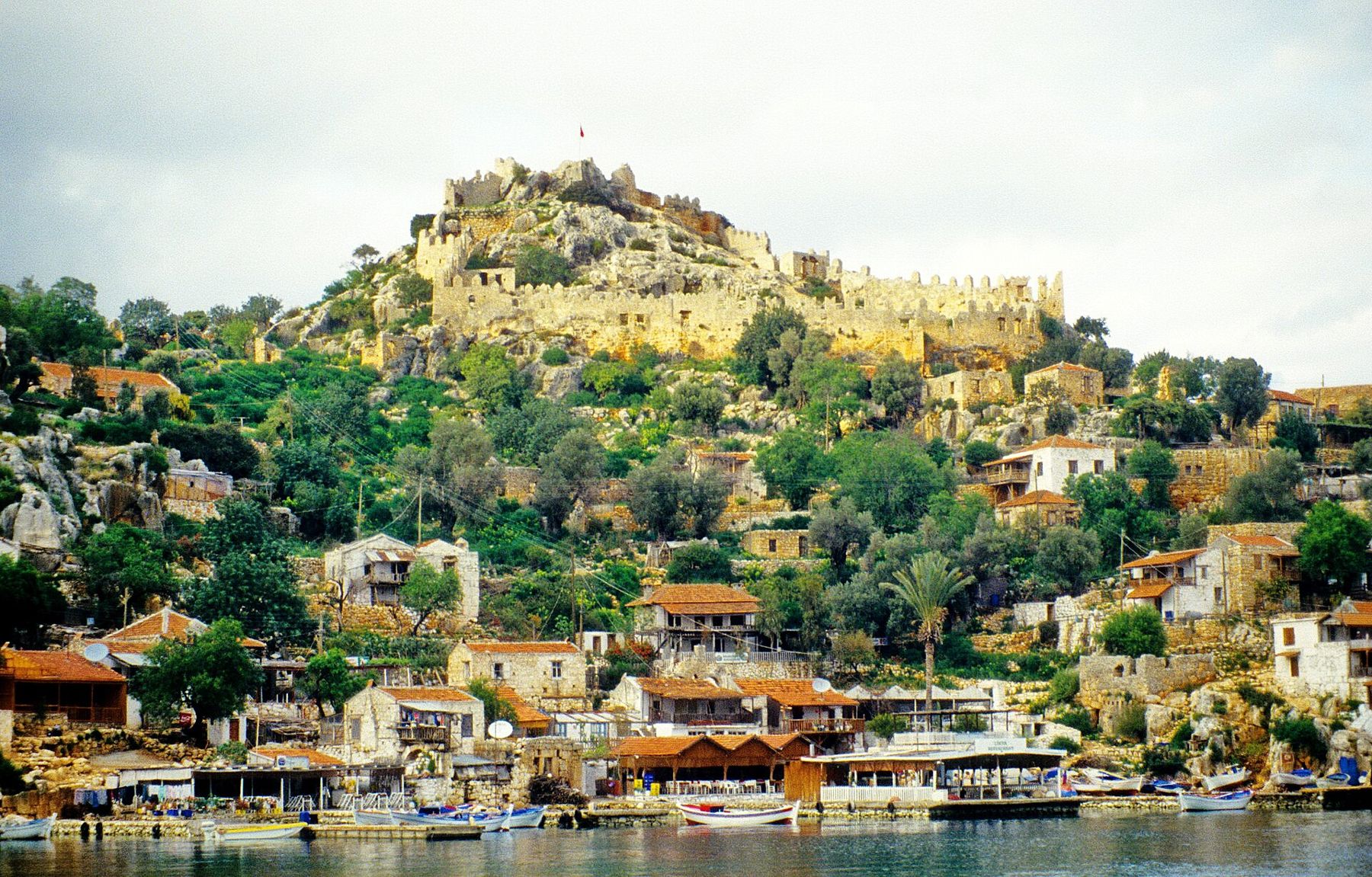
Across the channel from the island, Kaleköy is a small village of stone houses with no road access for ordinary traffic: you reach it by boat, or on foot along a path from Üçağız. Above it, on a rocky hill, stands the castle. Its walls with their crenellations are medieval, built over older foundations, and it is the most visible landmark on this coast.
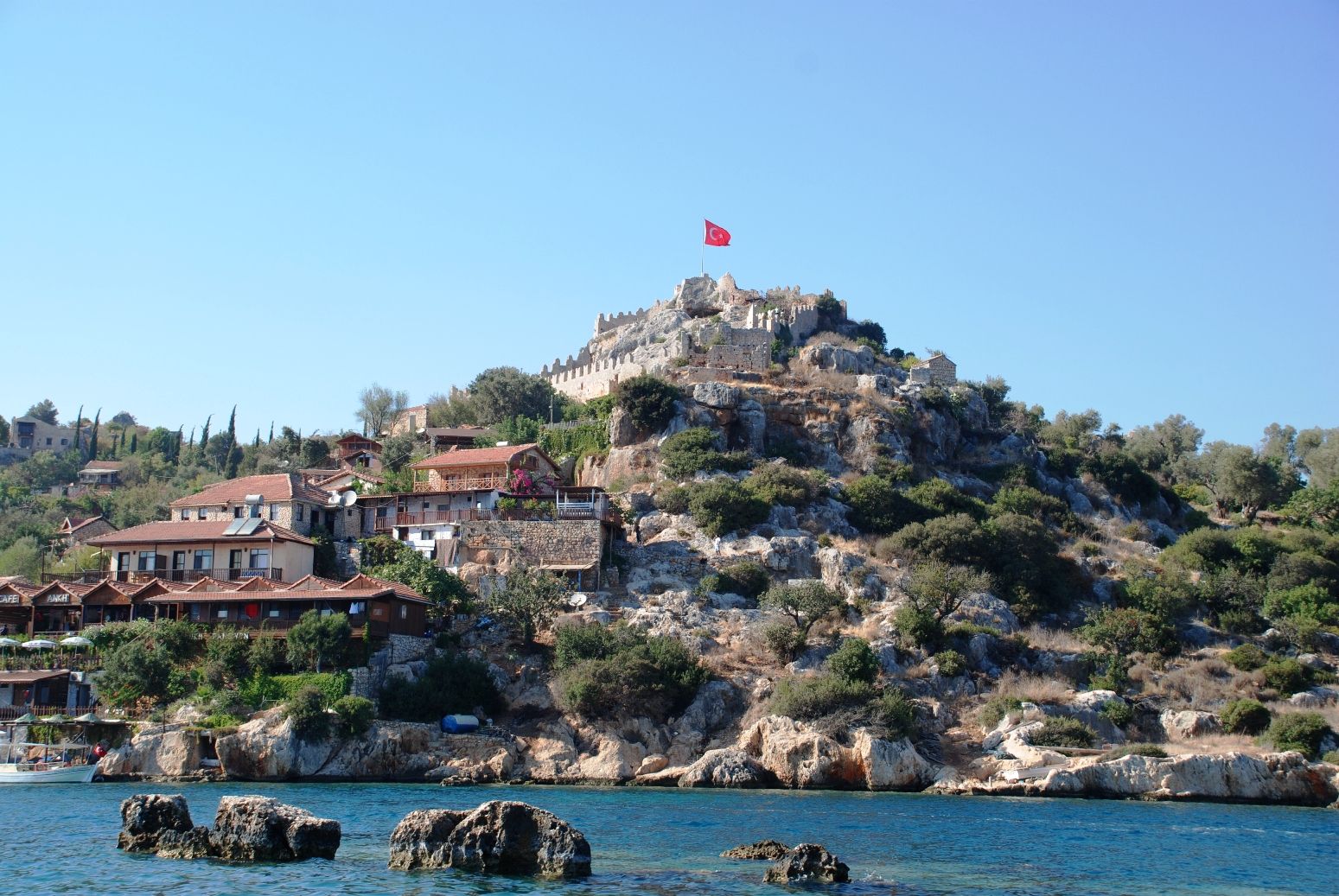
The climb up is short but steep, on uneven steps through the village, and fully in the sun. At the top you walk along the walls, look out over the islands and the channel, and find the castle's surprise: a very small theatre cut into the rock inside the walls, its few rows of seats facing out. It is among the smallest ancient theatres in the region and suits the scale of the place.
The ancient town of Simena was a minor Lycian city. Around the village and on the slopes you find rock-cut tombs and sarcophagi, and below the castle, standing in the water at the edge of the shore, the best-known of them: a Lycian sarcophagus with a pointed, arched lid, its base under the sea. The village has grown up around it, and boats pass close to it, but it remains a tomb, not a landing stage.
Üçağız and Teimiussa
Üçağız, the village at the head of the bay, is where many people begin, by boat or by road. It stands on the site of ancient Teimiussa, and on its eastern side there is a cemetery of Lycian sarcophagi spread over the rocks by the water. Some have lids with the Gothic-arch profile typical of the region, and some carry inscriptions. It is a quiet place to walk early or late, when the light is low and the grey limestone takes on colour.
Walk among the sarcophagi slowly. Many stand on a stepped base, with a separate chest above it and a heavy lid on top, and the lids often imitate a roof, with raised ridges along the curve and projecting bosses at the ends that may once have helped the masons lift them into place. Several have been broken open long ago, and the chests stand empty. Tombs like these were family monuments, and the inscriptions, where they survive, usually name the owner and those allowed to be buried with him, and sometimes warn of penalties for anyone who disturbs them.
This is a good spot to see how a Lycian necropolis sits in a landscape: on the edge between land and water, placed to be seen from the sea. If you want to make sense of what you see, read how to read a Lycian tomb and, for the inscriptions, the Lycian alphabet and bilingual stones.
Boat trips and timing
Most visitors see Kekova on a boat trip. Trips leave from Üçağız, and from further away from Kaş and from the Andriake area near Demre; the longer the trip, the more time you spend getting there and the less time among the ruins. Smaller boats and early departures make for a calmer experience. Trips usually pass along the sunken shore of the island, call at Kaleköy so you can climb to the castle, and stop elsewhere for swimming where it is permitted. Kayaking along the shore is also offered in the area; check current rules, since protected zones and permitted routes change.
- Spring and autumn give mild weather and calm water; high summer is hot and the channel is busy with boats.
- Check prices, inclusions and the route before you agree to any trip, and check whether the castle entry is included.
- The castle climb is exposed; carry water and avoid the middle of the day in summer.
- The sea is calmest in the morning; afternoon wind can make the water choppier and harder to see through.
Kekova fits well with Myra and its harbour at Andriake, only a short drive away, and with the walking country around it: sections of the Lycian Way pass close to Üçağız and Kaleköy.